About GeoUtil
Our Mission
GeoUtil exists to make accurate geographic measurements and data processing accessible to everyone. Whether you're a student measuring distances for a school project, a researcher analyzing spatial data, or simply curious about the true sizes of countries, our tools handle the complex mathematics so you can focus on what matters.
The Problem We Solve
The world is missing geography tools that are free, reliable, and available online without installing scripts, Python packages, or complex GIS software. The goal of this site is to provide those tools to everyone for free — accessible from your browser at your convenience, with no installation required.
Project History
GeoUtil started as a collection of tools created to support geography game development. As the author accumulated more and more useful tools for working with GeoJSON files, they wanted to share those with everyone — and that's how GeoUtil.com was born!
The project continues to grow based on community feedback from educators, researchers, developers, and geography enthusiasts worldwide.
Who Uses GeoUtil?
Educators & Students
Teachers use GeoUtil to demonstrate map projections and measure distances. Students calculate areas and export data for geography assignments—all without complex GIS software.
Developers & GIS Professionals
Developers use GeoUtil for quick GeoJSON validation, format conversions, and debugging spatial data. The deep-linkable tools integrate easily into workflows without server dependencies.
Map Enthusiasts & Travelers
Curious minds explore flight distances, compare country sizes, find antipodes, and satisfy geographic curiosity through interactive tools that make Earth's true geography tangible.
Technical Foundation
GeoUtil is built on proven open-source technologies:
- VitePress — Documentation framework for fast, accessible pages
- Vue.js — Reactive components for interactive tools
- Leaflet — 2D interactive mapping with custom spherical rendering
- Cesium — 3D globe visualization for immersive distance tools
- Turf.js — Accurate spherical geometry calculations
- OpenStreetMap — Community-built, open geographic data
All processing happens in your browser. No data uploads, no server tracking, no privacy compromises.
Privacy & Data Policy
Your data stays yours:
- ✅ No uploads — All tools run client-side in your browser
- ✅ No tracking — We don't collect usage data or analytics
- ✅ No accounts — Use all features without registration
- ✅ No cookies — No behavioral tracking or advertising
- ✅ Open source — Transparent, auditable code (coming soon)
Licensing & Commercial Use
All tools on GeoUtil.com are free for personal and commercial use. Maps, measurements, and exported data can be used in:
- Academic papers and reports
- Commercial publications and presentations
- Software applications and integrations
- Educational materials and tutorials
Attribution is appreciated but not required:
- Recommended: "Created with GeoUtil.com"
- Alternative: Keep the built-in watermark visible
- Minimal: Link to GeoUtil.com in your credits
Get in Touch
- Community: r/GeoUtil on Reddit — Feature requests, discussions, support
- Bug Reports: Post to Reddit
- Feature Ideas: All suggestions welcome via Reddit
- Collaboration: Contact via Reddit for partnerships or custom development
Related Projects
🗺️ GuessWhereYouAre — Geography Game
Test your spatial knowledge with GuessWhereYouAre! Drop into random Street View scenes worldwide and race to identify locations. Perfect for sharpening the geographic skills you develop with GeoUtil.

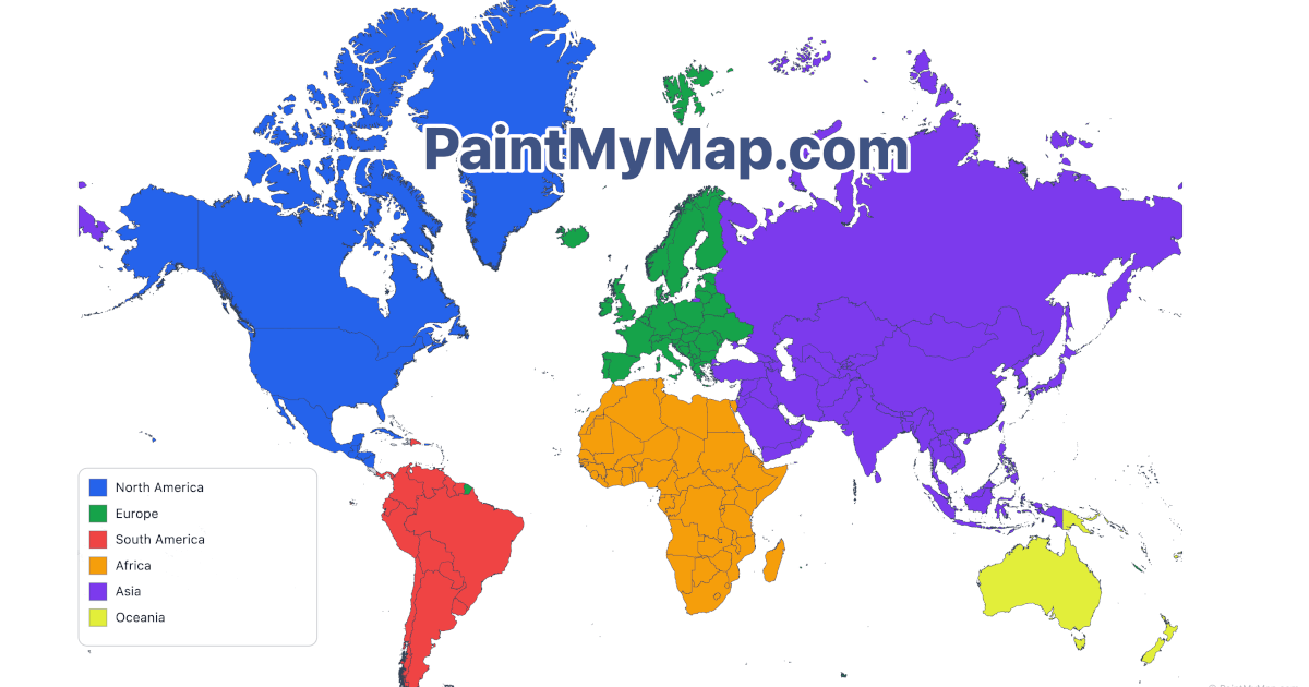
🎨 PaintMyMap — Professional Map Creator
Need publication-ready maps? PaintMyMap.com offers choropleth mapping, custom styling, and print-quality exports. GeoUtil handles measurements; PaintMyMap handles beautiful presentation.
📏 TrueSize — Interactive Size Comparison
Compare the real sizes of countries, regions, and continents with TrueSize.net! The most detailed size comparison tool available, supporting over 150,000+ subnational regions. Drag countries around the map to see how their true sizes compare when moved to different latitudes.
Thank you for using GeoUtil. Whether you're measuring one distance or processing thousands of coordinates, we're glad to help make geography more accessible.
🎵 TuneJourney.com — AI-Powered Global Radio Discovery
Looking for a smarter way to discover online radio stations worldwide? TuneJourney.com is a global radio discovery platform built for nonstop listening, fast station hopping, and personalized playback.
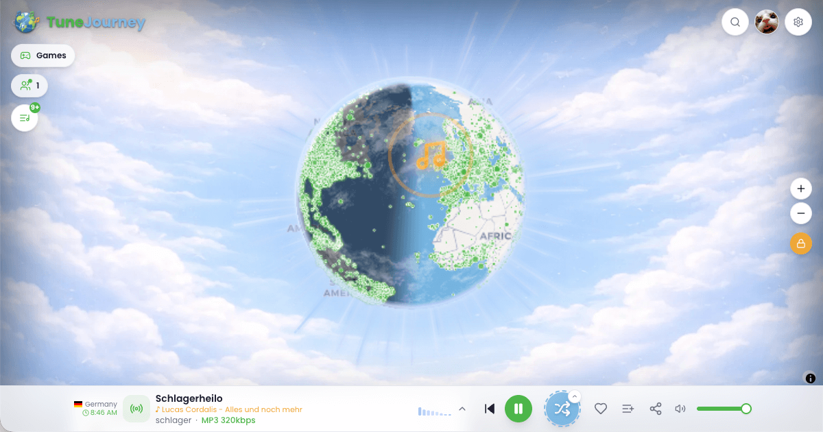
TuneJourney uses in-browser AI plus additional stream signals to estimate whether a live stream is mostly music or talk, then automatically switches stations based on your filters, playlist rules, or random world exploration.
Key Features
- AI music/talk detection for automatic station switching
- ~70,000 radio stations ("tunes") across ~11,000 locations ("journeys")
- Keyboard + media button controls (next/previous) on desktop and mobile devices
- Favorites and shareable playlists (sign-in required for persistent saves)
- Random worldwide station hopping for instant discovery
- Simple relaxing games (including Mahjong-style games) while listening
- Live activity and lightweight leaderboards showing who is listening, popular stations, and globe-hopping time
If you enjoy interactive geography and global exploration, TuneJourney complements GeoUtil with a new way to explore the world through live radio.